
History
A Brief History of Rock Bridge Park's Little Bonne Femme Creek

Photo of the Whiskey Distillery at Rock Bridge circa 1900
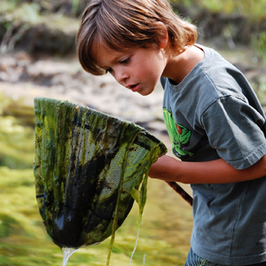
The Little Bonne Femme Creek, formed by the confluence of Gans and Clear Creeks at Rock Bridge Memorial State Park , has a rich history, including whiskey distilling, an amusement park, and an ocean. Humans have gathered there for a long time, due in part to the year-round flow of cool, clear water coming from the Devil's Icebox, a rarity in smaller streams of Central Missouri.
The Little Bonne Femme probably got its name in the 18th century, when it flowed into the Bonne Femme (this was changed when the quake of 1811 pushed the Missouri River over to the eastern side of its valley, thereby cutting off their confluence). Although the origin of the creek's name is unknown, it is possible 'Bonne Femme' is a translation into French for the Osage Indians' 'Good Woman', who led women in the Dance of Peace and agricultural ceremonies. The name of the creek originally went all the way up the Gans, which got its name when the highway department saw a Gans Bridge (named after a local property owner), and assumed that was the creek's name.
The Little Bonne Femme's watershed (the area of land that drains to the creek) is unique due to the meeting of two different landscapes: the Prairie and the Ozarks. Long before humans were a twinkle in their predecessor's eyes (approximately 250 million years ago, to be exact in geological time) a shallow ocean covered the area. Over the eons, oceanic creatures' skeletal remains formed the sedimentary rock called limestone. When rainwater combines with carbon dioxide from decaying plants, it forms a weak solution of carbonic acid that dissolves limestone. This dissolving process forms what we call karst topography (signified by sinkholes, losing streams, caves, and springs). Sinkholes and losing streams form a direct connection between surface water and groundwater, bypassing the natural filtering capability of soil.
As early as the 1880s, people understood that some of the water flowing from the Devil's Icebox came from the Bonne Femme Creek (located several miles to the south and east of Gans and the Little Bonne Femme Creeks). The Devil's Icebox Cave is the largest cave in Missouri north of the Missouri River , and seventh largest in the entire state. It has several endangered species, including one, the Pink Planarian, which is only found there. The cave has not been developed with paved paths or other human interventions. The Devil's Icebox Cave has been closed to the public since 2010 to protect bats in the cave from White-Nose Syndrome. Connor's Cave (accessed through the same opening also called the Devil's Icebox) can be explored without a guide or on tours led by Park staff.
About a million years ago, glaciers entered Missouri , flattening the landscape and depositing debris along the way. The glaciers stopped in southern Boone County , at the northern edge of the Ozarks. Prairies formed on glacial deposits located in the higher (eastern) parts of the watershed. The former prairies are excellent for row cropping due to their deep soils.
The story of humans in the area is long and varied. Native Americans have lived in the area periodically for over 10 thousand years. Many arrowheads have been found, in addition to evidence of mining the pieces to create them. There were no Native American villages established in the area at the time European settlers were moving in. It does not appear the native population had significant negative impacts on the streams.
The area was one of the first to be settled in Missouri (except for those areas along the Mississippi River, like St. Louis and Ste. Genevieve), and the commercial and agricultural activities helped make Boone County a leading economic producer in the state. Unfortunately, the economic strength came at the expense of slave labor, used widely in the area by the settlers from the South.
In the early 1820s, the brothers Thomas and Gilpin Tuttle built the first grist mill (for making flour) just down-stream from the rock bridge, even though they didn't own the land. It was an excellent site because of the constant supply of flowing water that powered the grind stones used for making flour. Nathan Glasgow officially bought the 107 acres around the bridge from the government in 1824 for the whopping price of $1.25/acre!
Over the next 80+ years, the area around Rock Bridge was a center of activity, mostly due to the stream. A synergy of businesses occurred there: the water-powered grist mill (more efficient than a horse-powered mill) ground locally-grown grain; the extra capacity of the mill was used to grind grain for a distillery (there was a lot of whiskey made there until a local prohibition passed in 1908); the distillery needed the high-quality water available from the Devil's Icebox stream; the combination of a by-product from the distillery (mash) and the hilly terrain in the immediate vicinity (which wasn't good for growing crops, but had plenty of acorns for fattening) was excellent for growing hogs; blacksmiths and coopers were needed to produce and maintain equipment for the mill and distillery; since the mill brought local farmers to the area to drop off their goods, it lent itself well to having a general store; tanyards were essential for making the leather products required in the abundant farm life of the area, and required a good water supply and plenty of oak bark (both found at that location).
The way some of these activities occurred degraded the stream. In the late 1840s, then-owner James McGonathy was sued by a down-stream landowner, the Smiths, because of all the pollution from the hog and distillery operations making the water unusable. Smith probably depended on the stream for drinking water and for his livestock. The case went all the way to the Missouri Supreme Court, where it was decided in favor of the Smiths. The court stated "…that the fish in the creek were destroyed and rendered unfit for use by the distillery" (the penalty: a $1 fine, plus giving all the whisky to the Smiths they wanted!). The tanning operations (1826-1866) had numerous discharges of foul wastes (animal wastes, lime, tannic acids, dyes, etc.) to Little Bonne Femme Creek. The tanning operation and the mill (converted to steam power in the mid 1840s) required large amounts of trees. The resulting clearing of trees caused a large amount of erosion on those lands. The eroded material ended up in the streams, further degrading the streams by causing siltation (which ruins habitat for aquatic life). It is believed that much of the mud in Devil's Icebox Cave originated in the clearing and farming in the 19th century. As this mud slowly moves out of the cave, new passages are uncovered. It is also believed that water flow in the springs during dry times has declined due to land clearing. More recently, there was an ammonia nitrate spill in the early 1980s that sterilized a segment of Gans Creek.
Although many of the 19th century industries no longer exist, choices we make often have negative effects for the streams. There are many actions we do everyday which can impact a stream: from picking up after your dog to disposing of waste oil properly to taking care of your lawn using little or no fertilizers and pesticides. These may not seem important since it is one person's action, but the effects on streams are from a combined total of actions by many people in many places throughout the watershed.
Bonne Femme Buzz

Get the latest highlights, actions, and events initiated by our Greater Bonne Femme Initiative partners to achieve water quality objectives on the Bonne Femme Buzz.
Heroes of Watershed
The community plays an important role in protecting the Bonne Femme Watershed. Find out how some in the community have been deemed Heroes of the Watershed.
Upcoming Events
View Full CalendarQuarterly Spotlight

Check out our Quarterly Spotlight to see the latest feature in watershed conservation efforts.